Level 5: The Climatology and Ecology of the 2026 Northwest Fires

Introduction to the 2026 Fire Season
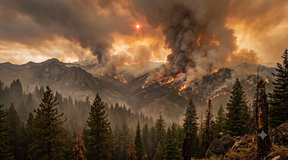
The wildland fire season in the Pacific Northwest during the summer of 2026 has developed into a period of pronounced environmental and atmospheric disturbance. By late July, the convergence of anomalous synoptic weather patterns, multi-year precipitation deficits, and critically low fuel moistures catalyzed the ignition and rapid spread of large-scale wildfires across Washington and Oregon. Regional coordination centers report that wildfires have consumed approximately one million acres in Oregon and over 125,000 acres in Washington1. In response to the escalating crisis and the intense demand for suppression resources, the Northwest Geographic Area elevated to Preparedness Level 3, while the National Interagency Fire Center raised the national preparedness to Level 5, its highest tier, signaling a severe depletion of available firefighting personnel and equipment across the country2.
The current fire status represents a manifestation of compounding climatological shifts, ecological vulnerabilities, and complex atmospheric chemistry interactions. Forest ecosystems in the region are facing sustained stress, leading to widespread observation of post-fire forest regeneration failure and the alteration of historical ecological succession5. Furthermore, the geographic distribution of these fires has intersected with extensive commercial carbon offset projects, presenting acute threats to the financial and environmental integrity of carbon sequestration initiatives governed by the California Air Resources Board7.
This analysis provides a comprehensive examination of the current fire status in the Pacific Northwest. It synthesizes real-time incident data with advanced meteorological principles, explores the mechanisms driving burn severity and forest resilience, details the atmospheric chemistry of wildfire smoke plumes, and evaluates the cascading socio-economic impacts on forest carbon offset markets.
Historical Context and Current Landscape Impacts
To understand the magnitude of the July 2026 fire season, it is necessary to contextualize the current landscape impacts against historical baselines. In the era prior to rigorous fire suppression (the 19th century), massive fires such as the 1865 Silverton Fire burned upwards of 900,000 acres in Oregon9. The mid-20th century saw the implementation of aggressive suppression policies, which successfully limited annual acreage burned but inadvertently led to a massive accumulation of forest fuels. Beginning in the early 2000s, warming temperatures and increased fuel loading facilitated the return of megafires, such as the 2002 Biscuit Fire and the 2020 Labor Day fires, the latter of which included the 173,439-acre Holiday Farm Fire9.
The 2026 season represents an acceleration of this modern trend. A comparative analysis of early-season data highlights a marked increase in both fire frequency and suppression expenditures compared to the previous year. By late July 2025, Oregon reported seven active large fires burning roughly 102,700 acres; by the same date in 2026, the state recorded 42 large fires encompassing over 406,000 acres11.
Comparison of Oregon Wildfire Activity: July 2025 vs. July 2026
Metric | July 21, 2025 | July 21, 2026 | Trend Indicator |
Active Large Fires | 7 | 42 | 500 percent increase11. |
Total Acres Burned (Large Fires) | 102,791 | 406,846 | Nearly 300 percent increase11. |
Estimated Suppression Costs | 61.8 million dollars | 90.9 million dollars | 47 percent increase11. |
National Preparedness Level | Level 3 or lower | Level 5 (Maximum) | Severe national resource depletion3. |
Specific Incident Dynamics
The wildland fire landscape in July 2026 is characterized by multiple complex incidents burning primarily in dry, fuel-loaded environments across the eastern slopes of the Cascade Range, the Columbia Basin, and the interior ranges of Oregon. The immediate catalyst for many of these fires was a series of dry lightning storms initiated by subtropical moisture drawn northward from the remnants of Tropical Storm Elida12.
Among the most critical incidents is the Akawa Butte Fire, located near Sisters, Oregon. Designated as the highest priority incident in the region by the Northwest Interagency Coordination Center, the fire has exhibited highly complex behavior dictated by local topography. The physical presence of Black Butte causes prevailing westerly winds to split, creating erratic, multi-directional fire spread that poses an immediate threat to nearby communities13. The situation is further complicated because much of the fire is burning through privately-owned timberlands that were historically "high-graded" (a logging practice that removed the largest, most fire-resistant trees), leaving a younger, highly combustible forest structure13.
In central Oregon, the Hay Creek Complex demonstrates the profound impact of wind-driven runs. Strong westerly winds pushed the Little Buck Fire, a component of the complex, across critical containment lines, notably jumping a section of Oregon Highway 218 near Clarno. The complex quickly expanded to over 168,000 acres, sustained by extremely dry sagebrush and grass fuels14.
Simultaneously in Washington, the Kaiser Canyon Fire and the Modrite Fire are burning extensively on the Colville Reservation. The Kaiser Canyon Fire alone grew by more than 30,000 acres in a single 24-hour period, forcing over 1,000 evacuations and destroying multiple structures as it moved toward Omak Lake15. The ecological and economic ramifications of these specific fires are profound, as they are actively consuming dense timber managed explicitly for commercial carbon sequestration13.
The threat to the Wildland Urban Interface is a primary operational concern across all these incidents. Mitigation efforts heavily emphasize the concept of the Home Ignition Zone, particularly "Zone 0," which mandates a 5-foot noncombustible perimeter around structures to prevent ignition from the embers cast by these high-intensity fires17.
Synoptic Meteorology and Fire Weather Dynamics
The severity of the July 2026 fire season is inextricably linked to specific synoptic-scale meteorological patterns and localized thermodynamic variables that govern the drying of wildland fuels. The convergence of macro-level atmospheric pressure systems and micro-level moisture deficits has created an optimal environment for fire ignition and propagation.
The Role of the 500-Millibar Ridge
The primary synoptic driver of critical fire weather in the Pacific Northwest is the presence of an amplified, high-pressure ridge at the 500-millibar atmospheric level (approximately 18,000 feet above sea level). In atmospheric dynamics, a 500-millibar ridge is characterized by anticyclonic (clockwise) flow and large-scale descending air, a process known as subsidence19.
As air descends within this high-pressure system, it undergoes adiabatic warming. The increasing atmospheric pressure at lower altitudes compresses the descending air mass, causing its temperature to rise and its relative humidity to plummet. This subsidence not only increases surface temperatures but also suppresses cloud formation and precipitation, creating a stagnant, exceptionally dry air mass over the region19. The ridge acts as a blocking mechanism, deflecting the polar jet stream and any moisture-bearing Pacific storm systems far to the north into Canada20. During July 2026, this blocking ridge became semi-stationary, prolonging the exposure of forest fuels to intense solar radiation and minimizing overnight humidity recovery20.
Furthermore, the interaction between this upper-level ridge and surface thermal troughs can generate strong, localized pressure gradients. These gradients drive dry, gusty offshore winds or channeled valley winds that act as a forced convective mechanism, rapidly accelerating fire spread and promoting long-range spotting (the transport of burning embers ahead of the main fire front)23.
Vapor Pressure Deficit (VPD)
While temperature and relative humidity are commonly cited fire weather metrics, atmospheric scientists and fire ecologists increasingly rely on Vapor Pressure Deficit (VPD) as the most accurate predictor of fuel aridity and fire potential. VPD represents the absolute difference between the amount of moisture the atmosphere can hold at a given temperature (saturation vapor pressure) and the amount of moisture currently present in the air (actual vapor pressure)26.
Unlike relative humidity, which is a proportional measure, VPD quantifies the absolute thermodynamic "thirst" of the atmosphere. A high VPD exerts a strong evaporative pull, directly extracting moisture from living plants and dead wildland fuels27. Dead fuels, such as leaf litter and downed timber, respond passively to VPD, rapidly reaching their equilibrium moisture content. Research indicates that VPD explains more variance in burned forest area across the western United States than precipitation, temperature, or wind individually27.
During the July 2026 events, the Pacific Northwest experienced sustained periods of extreme VPD, driven by the subsidence warming of the 500-millibar ridge and a persistent lack of precipitation2. This atmospheric thirst effectively primed the landscape, rendering typically fire-resistant live vegetation highly flammable and significantly reducing the time required for a small ignition to transition into a large-scale conflagration2.
Energy Release Component (ERC) and 1000-Hour Fuel Moisture
The National Fire Danger Rating System utilizes several indices to quantify fire risk, with the Energy Release Component (ERC) being one of the most critical for strategic planning. The ERC estimates the available potential energy, measured in British Thermal Units per square foot, within the flaming front of a fire29. It is a cumulative metric that reflects the moisture content of both live and dead fuels across various size classes30.
Because the ERC integrates the drying effects of past weather over time, it serves as a highly reliable indicator of seasonal drought and long-term fire potential. In July 2026, ERC values across much of the Pacific Northwest exceeded the 90th and, in some cases, the 97th percentiles of historical averages22. This indicates that upon ignition, the total heat released is exceptionally high, heavily complicating direct suppression tactics.
A primary input to the ERC is the 1000-hour fuel moisture, which represents the moisture content of large dead logs and heavy timber ranging from three to eight inches in diameter30. The "1000-hour" designation indicates the approximate time lag required for these heavy fuels to reach equilibrium with atmospheric moisture. By July 2026, 1000-hour fuel moistures had dropped to critically low single-digit percentages across the region33. When heavy fuels are this dry, they ignite easily, burn with immense intensity, and contribute to severe soil heating, which can alter the physical structure of the soil and promote post-fire hydrophobicity (water repellency)36.
Remote Sensing, Burn Severity, and Forest Resilience
The combination of extreme VPD, critically high ERC, and dense fuel loading dictates not just how a fire burns, but the severity of its ecological impact. The long-term trajectory of Pacific Northwest forests hinges on burn severity and the capacity of native flora to regenerate in a heavily altered post-fire environment.
Quantifying Burn Severity: The Differenced Normalized Burn Ratio
To evaluate the ecological impact of the July 2026 fires, remote sensing analysts utilize multispectral satellite imagery, such as data from the Landsat 8 Operational Land Imager and the Sentinel-2 MultiSpectral Instrument, to measure burn severity38. The standard metric is the Differenced Normalized Burn Ratio (dNBR), which compares near-infrared and shortwave-infrared reflectance before and after a fire39. Near-infrared light is strongly reflected by healthy, chlorophyll-rich vegetation, while shortwave-infrared light is strongly absorbed by vegetation but highly reflected by bare soil and burned biomass40.
However, the absolute dNBR can be biased by the pre-fire density of the vegetation. For example, the absolute change in greenness in a dense forest will appear much higher than the change in a sparse woodland, even if both experienced complete mortality. To correct for this, analysts apply the Relative Differenced Normalized Burn Ratio (RdNBR)38. The RdNBR normalizes the severity metric against the pre-fire baseline by dividing the absolute difference by the square root of the pre-fire condition, providing a highly accurate assessment of true vegetation mortality40.
Early assessments from the 2026 fire season indicate vast contiguous patches of high-severity fire (defined as greater than 75 percent basal area mortality) in the interior forests38. This represents a stark deviation from historical norms, where high-severity patches were typically smaller and interspersed with low-severity refugia42.
Post-Fire Regeneration and the "Interval Squeeze"
One of the most alarming ecological developments exacerbated by the 2026 fire season is the increasing failure of conifer regeneration in lower-elevation dry forests. Historically, dominant canopy species like Ponderosa Pine and Douglas-fir exhibited strong resilience to fire, provided that mature seed-bearing trees survived nearby and post-fire conditions were favorable for seed germination5. However, the current landscape is experiencing a phenomenon known as "interval squeeze," wherein the time between severe fires is shortening, and the post-fire climate is becoming too harsh for vulnerable seedlings to establish5.
Recent longitudinal studies emphasize that post-fire conifer regeneration exhibits a non-linear threshold response to annual climate conditions. Specifically, maximum surface temperature, soil moisture, and vapor pressure deficit dictate the survival of newly germinated seeds5. The Pacific Northwest has frequently crossed these critical climate thresholds over the past two decades. When large, stand-replacing fires occur in these altered climate spaces, the destruction of the mature canopy eliminates the local seed source. More critically, it removes the microclimate shading necessary to protect fragile germinants from lethal surface temperatures5.
Without this protective canopy, soil surface temperatures spike, and elevated VPD rapidly desiccates seedlings whose shallow root systems cannot access deeper soil moisture reserves46. Consequently, vast areas of formerly forested land in Oregon and Washington are actively transitioning into alternative stable states43.
Ecological Succession and Alternative Stable States
As conifers fail to regenerate, post-fire landscapes are frequently colonized by aggressive, early-successional shrubs and invasive grasses. In the Klamath and Cascade regions, shrub species like Ceanothus integerrimus rapidly dominate the understory. While Ceanothus is a nitrogen-fixing plant that can theoretically enrich the soil, its explosive growth creates intense competition for light and soil moisture, effectively shading out and out-competing any remaining Douglas-fir seedlings45.
In drier, lower-elevation regions, the transition is often driven by invasive annual grasses, notably cheatgrass (Bromus tectorum)48. Cheatgrass alters the fundamental ecological cycle by creating a continuous bed of fine, highly flammable fuel that cures early in the summer. This drastically reduces the fire return interval, promoting highly frequent, low-intensity surface fires that perpetually kill any emerging conifer seedlings, locking the ecosystem into a permanent grass-fire cycle43.
Atmospheric Chemistry: Smoke Plume Evolution and Secondary Aerosols
The massive volumes of biomass consumed by the July 2026 wildfires have resulted in the injection of immense quantities of trace gases and particulate matter into the troposphere. The atmospheric chemistry of wildfire smoke is not static; its composition alters drastically within minutes to days of emission through complex photochemical oxidation processes, severely impacting regional air quality and atmospheric thermodynamics49.
Primary Emissions and Secondary Organic Aerosol (SOA) Formation
Wildfires emit a complex mixture of primary organic aerosols, black carbon, brown carbon, nitrogen oxides (NOx), and nonmethane organic gases (NMOGs)51. As the smoke plume travels downwind and is exposed to ultraviolet sunlight, the gaseous VOCs and NMOGs undergo rapid photochemical oxidation, catalyzed primarily by the hydroxyl radical and ozone49.
These oxidation reactions reduce the volatility of the organic gases, causing them to condense onto existing particles or nucleate into entirely new particles, a process that forms Secondary Organic Aerosols (SOA)49. The formation of SOA significantly increases the total aerosol mass in the aging smoke plume. Research demonstrates that during long-range transport, the mass of organic aerosols can enhance by factors of two to eight compared to primary emissions49. Furthermore, the oxygen-to-carbon ratio of the particles increases, making them more hygroscopic (water-attracting), which alters their ability to act as cloud condensation nuclei49.
Aqueous-phase chemistry also plays a critical role. When water-soluble organic gases from biomass burning partition into atmospheric liquid water, they undergo radical reactions to form highly oxidized, high-molecular-weight compounds and carboxylic acid salts, such as oxalates. Upon the evaporation of the water droplet, these secondary compounds remain in the aerosol phase, further contributing to the total SOA mass52.
Brown Carbon and Ozone Photochemistry
A vital component of the wildfire aerosol matrix is Brown Carbon (BrC). While black carbon absorbs light uniformly across the visible spectrum, BrC preferentially absorbs short-wavelength visible and ultraviolet light51. In moderately aged smoke, BrC has been observed to account for up to 50 percent of total aerosol absorption at the 401-nanometer wavelength53. By absorbing UV radiation, BrC locally heats the atmosphere, affecting atmospheric stability and cloud formation. More importantly, it competes for the UV photons necessary to drive the photolysis of nitrogen dioxide, thereby fundamentally altering local photochemical reaction rates51.
The generation of ground-level ozone within smoke plumes is another significant atmospheric hazard. While fires emit limited primary ozone, they release extraordinarily high concentrations of its precursors: NOx and VOCs50. As the plume dilutes and mixes with background air, the ratio of VOCs to NOx shifts into an optimal range for ozone production. Photochemical reactions in the aging plume can generate substantial ozone enhancements. Studies indicate that aging plumes can raise surface ozone levels by significant margins, frequently contributing to enhancements of 30 parts per billion or more in downwind environments50.
Additionally, nighttime chemistry involving the nitrate radical (NO3) reacting with NMOGs contributes to ongoing secondary aerosol and brown carbon formation even in the absence of sunlight53. Measurements from high-altitude sites, such as the Mt. Bachelor Observatory, confirm that highly oxidized biomass burning organic aerosols persist in the regional background air for days, underscoring the widespread impact of these plumes on the atmospheric chemistry of the western United States51.
Consequently, populations hundreds of miles downwind of the Cascade and Columbia Basin fires are subjected to heavily oxidized, highly toxic secondary organic aerosols and elevated ozone levels, which present unique and severe public health risks distinct from the primary particulate matter measured directly at the fire line50.
Socioeconomic and Policy Implications: The Collapse of Carbon Offset Projects
While the ecological and atmospheric consequences of the July 2026 fires are profound, a critical third-order impact has emerged in the realm of environmental economics and climate policy. The spatial footprint of the current wildfires intersects heavily with forests explicitly designated and monetized as carbon sequestration projects under the California Air Resources Board (CARB) cap-and-trade program13.
The logic of forest carbon offsets relies on the premise of permanence—the guarantee that a forest will securely store atmospheric carbon for a minimum of 100 years8. Regulated polluting entities purchase these offset credits to justify ongoing greenhouse gas emissions. To account for the risk of "unintentional reversals" (where stored carbon is released back into the atmosphere due to uncontrollable events like wildfire, drought, or disease), the CARB system mandates that a portion of the credits generated by each project be deposited into a communal "buffer pool"7.
Mechanics and Vulnerability of the Buffer Pool
The buffer pool acts as a self-insurance mechanism for the entire market. If a participating forest burns, credits from the buffer pool are retired to ensure the overall permanence claim of the market remains intact7. Depending on specific land management and environmental factors, a project contributes between 8.7 and 19.2 percent of its total credited carbon to the buffer pool59. Crucially, however, the allocation explicitly designated for wildfire risk is only 2 to 4 percent, with other fixed percentages assigned to disease (3 percent), catastrophic natural risks like wind (3 percent), and financial mismanagement or bankruptcy (1 to 9 percent)8.
Actuarial analyses of the CARB buffer pool reveal a fatal structural flaw: the system fundamentally underestimated the escalating frequency and severity of climate-driven wildfires in the western United States7. In less than a decade of operation, wildfire emissions have wiped out nearly the entirety of the buffer pool's designated 100-year fire contribution7.
Systemic Insolvency and Project Terminations
The July 2026 fire season has exacerbated an already critical crisis in the offset market, as several massive carbon projects have been incinerated. The Kaiser Canyon and Modrite fires are currently actively burning through the Colville Reservation's offset project (ACR255), one of the largest in the nation16. Previous fires had already inflicted severe reversals on this specific project, resulting in reported losses of 3.95 million credits and pushing the project toward formal termination7.
Under program rules, if a project's standing carbon stocks fall below its baseline level due to catastrophic loss, it is automatically terminated. When termination occurs, the buffer pool is required to retire a number of credits equal to the total amount ever issued to that project, not just the volume lost in the fire7. The pending termination of ACR255 alone would require the retirement of approximately 15.2 million credits—an event that would single-handedly consume nearly half of the entire existing buffer pool7.
Simultaneously, the Box Springs Fire has rapidly consumed approximately 80 percent of the Opal Mountain carbon storage project (CAR1102), vaporizing credits previously purchased by major utility companies and industrial polluters16. Other projects, such as the Warm Springs (ACR260) and Klamath East (ACR273), have recently been confirmed for termination due to catastrophic losses from preceding fire seasons, triggering the retirement of millions of additional credits16.
High-Profile Carbon Offset Projects Impacted by Wildfires
Project Name | Registry ID | Status / Recent Fire Impact | Implication for Buffer Pool |
Colville Reservation | ACR255 | Active fire impact (Kaiser Canyon, Modrite). High winds and fire previously caused 3.95 million credit loss7. | Approaching termination threshold; would require retirement of ~15.2 million credits7. |
Opal Mountain | CAR1102 | ~80 percent of project area consumed by Box Springs Fire in July 202616. | Immediate and substantial retirement of buffer credits required16. |
Warm Springs | ACR260 | Severely damaged by previous fires (e.g., Lionshead); formally slated for termination16. | Triggers the retirement of at least 2.68 million credits61. |
Klamath East | ACR273 | Confirmed termination following severe fire damage61. | Direct deduction of 1.14 million credits from the shared insurance pool7. |
Because all credits in the buffer pool are cross-fungible, the regulator must now cannibalize credits originally set aside for disease, insect infestation, or financial bankruptcy to cover the massive wildfire deficits7. The widespread incineration of these projects indicates that the industrial carbon pollution emitted under the cap-and-trade program, theoretically offset by these specific forests, represents a net-positive addition of greenhouse gases to the atmosphere. This fundamentally undermines the environmental integrity and mathematical validity of the cap-and-trade policy framework8.
Conclusion
The July 2026 fire status in the Pacific Northwest underscores a critical inflection point in the behavior and broader impact of wildland fire. The immediate operational reality is dictated by an extreme, ridge-driven synoptic weather pattern, which has forced the vapor pressure deficit to exceptional levels and dried heavily accumulated 1000-hour wildland fuels to historic minimums20. Consequently, current fire behavior exhibits intense energy release components that are largely resistant to traditional suppression efforts, demanding vast logistical commitments under a maximum National Preparedness status2.
However, the cascading impacts of these fires extend far beyond the immediate containment lines. Ecologically, the unprecedented size of high-severity burn patches, coupled with an increasingly hostile and arid post-fire climate, is severing the resilience mechanisms of dominant conifer species. Douglas-fir and Ponderosa Pine forests are facing widespread, climate-induced regeneration failure, signaling an abrupt ecosystem transition toward non-forest, highly flammable shrublands and grasslands5.
Atmospherically, the vast injection of complex organic compounds into the troposphere results in the rapid photochemical formation of highly oxidized secondary organic aerosols and ground-level ozone. This chemical evolution fundamentally magnifies the public health and climatological impacts of the smoke plume as it undergoes long-range transport49.
Finally, the 2026 fire season exposes the fragility of market-based climate mitigation strategies that rely on biological carbon storage. The catastrophic loss of commercial forest carbon offset projects across Washington and Oregon reveals a foundational miscalculation of climate risk within the cap-and-trade framework8. The effective insolvency of the program's buffer pool illustrates that natural ecosystems, when subjected to accelerated climatic extremes, cannot be reliably underwritten as permanent carbon vaults7.
As the 2026 fire season continues to evolve, the interconnected realities of meteorology, ecology, atmospheric chemistry, and policy highlight the urgent need for a systemic reevaluation of how fire risk is modeled, how post-fire landscapes are managed, and how economic instruments are constructed to combat global climate change.
Works cited
California, Oregon wildfires burns down over a 150,000 acres | The Business Standard, https://www.tbsnews.net/worldbiz/usa/california-oregon-wildfire-burns-down-over-150000-acres-905361
Firefighters ready to respond as fire potential increases in the Pacific Northwest, https://www.fs.usda.gov/r06/newsroom/releases/firefighters-ready-respond-fire-potential-increases-pacific-northwest
Wildfire alert in the Western U.S. reaches its highest level - KLCC, https://www.klcc.org/npr-top-stories/2026-07-25/wildfire-alert-in-the-western-u-s-reaches-its-highest-level
Federal fire officials raise wildfire preparedness level to its highest level - WJCT News, https://news.wjct.org/national-news/2026-07-22/federal-fire-officials-raise-wildfire-preparedness-level-to-its-highest-level
Wildfires and climate change push low-elevation forests across a critical climate threshold for tree regeneration | PNAS, https://www.pnas.org/doi/10.1073/pnas.1815107116
Reduced fire severity offers near-term buffer to climate-driven declines in conifer resilience across the western United States | PNAS, https://www.pnas.org/doi/10.1073/pnas.2208120120
California forest carbon buffer pool update – CarbonPlan, https://carbonplan.org/blog/buffer-analysis-update
California's forest carbon offsets buffer pool is severely undercapitalized - Frontiers, https://www.frontiersin.org/journals/forests-and-global-change/articles/10.3389/ffgc.2022.930426/full
benton county - community wildfire protection plan, https://cd.bentoncountyor.gov/wp-content/uploads/2023/11/march_web_draft.pdf
Lane County MNHMP V4_Full Plan (2).pdf - Products, https://cdnsm5-hosted.civiclive.com/UserFiles/Servers/Server_3585797/Image/Government/County%20Departments/Emergency%20Management/Planning%20Page/Lane%20County%20MNHMP%20V4_Full%20Plan%20(2).pdf
Oregon wildfire season outpacing 2025, showing similarities to record-setting 2024, https://dailydispatch.com/fire-news/oregon/oregon-wildfire-season-outpacing-2025-showing-similarities-to-record-setting-2024/
Akawa Butte Blowup and Rain, PNW Forest Carbon Projects Get Smoked! - 7/22/2026, https://the-lookout.org/2026/07/23/akawa-butte-blowup-and-rain-pnw-forest-carbon-projects-get-smoked-7-22-2026/
Hay Creek Complex Map - Watch Duty, https://app.watchduty.org/i/109623
110,000 acres burn as hot, dry weather fuels large wildfires across Washington | king5.com, https://www.king5.com/article/news/local/wildfire/hot-dry-weather-new-wildfire-washington/281-6b0bf814-e155-4d16-9f0b-f785c1b5e2e8
New Fires in PNW, More Carbon Projects Getting Smoked - 7/24/2026 - The Lookout, https://the-lookout.org/2026/07/24/pacific-northwest-fire-update-7-24-2026/
Community Wildfire Protection Plan - Washington Department of Natural Resources, https://dnr.wa.gov/publications/rp_burn_cwpp_kittitasco.pdf
wui vegetation code workgroup regular meeting september 17, 2025, https://berkeleyca.gov/sites/default/files/legislative-body-meeting-agendas/September17Agenda.pdf
Untitled, https://journals.ametsoc.org/view/journals/apme/9/5/1520-0450_1970_009_0740_maoahw_2_0_co_2.pdf
modeling and attainment demonstrations appendix d - San Joaquin Valley Air District, https://www.valleyair.org/media/iewdpnyu/appendixd-arbfinal.pdf
The Disastrous Southern California and Central Arizona Floods, Flash Floods, and Mudslides of February 1980 A Report to the Admi - the NOAA Institutional Repository, https://repository.library.noaa.gov/view/noaa/47161/noaa_47161_DS1.pdf
National Significant Wildland Fire Potential Outlook, https://docs.house.gov/meetings/II/II10/20260604/119331/HHRG-119-II10-20260604-SD009.pdf
WA & North ID Fire Weather Briefing - July 23, 2026 - YouTube, https://www.youtube.com/watch?v=HcfYDABPWM4
The interaction of northern wind flow with the complex topography of Crete Island–Part 1: Observational study - ResearchGate, https://www.researchgate.net/publication/40892407_The_interaction_of_northern_wind_flow_with_the_complex_topography_of_Crete_Island-Part_1_Observational_study
Convection Parameters from Remote Sensing Observations over the Southern Great Plains, https://www.mdpi.com/1424-8220/25/13/4163
Seasonal Predictability of Vapor Pressure Deficit in the western United States - WCD, https://wcd.copernicus.org/articles/6/1443/2025/
Climatology, Variability, and Trends in the U.S. Vapor Pressure Deficit, an Important Fire-Related Meteorological Quantity*, https://journals.ametsoc.org/view/journals/apme/54/6/jamc-d-14-0321.1.pdf
Past Variance and Future Projections of the Environmental Conditions Driving Western U.S. Summertime Wildfire Burn Area - PMC, https://pmc.ncbi.nlm.nih.gov/articles/PMC7900977/
Wildfire Risk Products - WA DNR, https://dnr.wa.gov/sites/default/files/2026-01/rp_wildfire_risk_products_analysis.pdf
Fire Danger: NFDRS System Inputs and Outputs | NWCG, https://www.nwcg.gov/publications/pms437/fire-danger/nfdrs-system-inputs-and-outputs
Season-ending Analysis | Risk Management Assistance (RMA) Dashboard - ArcGIS Experience Builder, https://experience.arcgis.com/experience/f9d7f7f920494c3db43a23a8dffe4664/page/Season-ending-Analysis
The 1978 National Fire-Danger Rating System : technical, https://upload.wikimedia.org/wikipedia/commons/6/6c/The_1978_National_Fire-Danger_Rating_System_-_technical_documentation._-_%28IA_CAT85822470%29.pdf?utm_source=commons.wikimedia.org&utm_campaign=index&utm_content=original
2026-2028 Wildfire Mitigation Plan - OPUC, https://edocs.puc.state.or.us/efdocs/HAQ/um2208haq342688028.pdf
National Significant Wildland Fire Potential Outlook, https://www.nifc.gov/sites/default/files/NICC/2-Predictive%20Services/Outlooks/NSWF%20-%20Potential%20Outlook/2025/September/monthly_seasonal_outlook.pdf
EMERGENCY FIRE COST COMMITTEE MEETING - Oregon.gov, https://www.oregon.gov/odf/board/documents/efcc/20250902-efcc-meeting-materials.pdf
Impacts of Wildfire Severity on Hydraulic Conductivity in Forest, Woodland, and Grassland Soils, https://research.fs.usda.gov/download/treesearch/41595.pdf
Does Cold Wildfire Smoke Contribute to Water Repellent Soils in Burned Areas? - DRI, https://www.dri.edu/does-cold-wildfire-smoke-contribute-to-water-repellent-soils-in-burned-areas/
Oregon 2020 Wildfires Vegetation Mortality - Overview - ArcGIS Online, https://www.arcgis.com/home/item.html?id=3f87d1e7ba2346f9bf155c3c7bb84405
Background, Products & Applications | RAVG - Burn Severity Portal, https://burnseverity.cr.usgs.gov/ravg/background-products-applications
Calibration and validation of the relative differenced Normalized Burn Ratio (RdNBR) to three measures of fire severity in - Forest Service Research and Development, https://research.fs.usda.gov/download/treesearch/35671.pdf
FINAL REPORT - Northern Rockies Fire Science Network, https://nrfirescience.org/sites/default/files/2024-11/21-1-01-26_final_report.pdf
1. ADMINISTRATIVE INFORMATION: Principal Investigator: Katie Dugger USGS, Oregon Cooperative Fish and Wildlife Research Unit, Or - Fire Refugia Project |, https://firerefugia.forestry.oregonstate.edu/export/fire_refugia_casc_final_report_dugger_reviewed_watermark.pdf
Post-fire Tree Regeneration (or Lack Thereof) Can Change Ecosystems, https://www.nrfirescience.org/sites/default/files/TreeRegenerationReviewFinal_compressed_0.pdf
Post-fire structural forest recovery associated with climate extremes in dry sub-boreal forests, https://pmc.ncbi.nlm.nih.gov/articles/PMC12779702/
Climatic Aridity Shapes Post-Fire Interactions between Ceanothus spp. and Douglas-Fir (Pseudotsuga menziesii) across the Klamath Mountains - Harvard Forest, https://harvardforest1.fas.harvard.edu/publications/pdfs/Cinoglu_Forests_2021.pdf
Soil moisture strongly limits Douglas-fir seedling establishment near its upper elevational limit in the southern Rocky Mountains, https://cdnsciencepub.com/doi/abs/10.1139/cjfr-2019-0296
Patterns and drivers of post-fire tree regeneration across gradients of climate and burn severity in Eastern Washington, https://dnr.wa.gov/sites/default/files/2025-08/rp_donato_fire_regen.pdf
Wildland Fire and Invasive Species Published Research - DOI.gov, https://www.doi.gov/sites/default/files/documents/2024-07/20240715-published-research-summary.pdf
Formation of secondary organic aerosol from wildfire emissions enhanced by long-time ageing (Journal Article) - OSTI, https://www.osti.gov/pages/biblio/2349000
Investigating the links between ozone and organic aerosol chemistry in a biomass burning plume from a prescribed fire in Califor - ScholarWorks at University of Montana, https://scholarworks.umt.edu/cgi/viewcontent.cgi?article=1100&context=chem_pubs
Persistent Influence of Wildfire Emissions in the Western United States and Characteristics of Aged Biomass Burning Organic Aerosols under Clean Air Conditions | Environmental Science & Technology - ACS Publications, https://pubs.acs.org/doi/10.1021/acs.est.1c07301
Photochemical Cloud Processing of Primary Wildfire Emissions as a Potential Source of Secondary Organic Aerosol | Environmental Science & Technology - ACS Publications, https://pubs.acs.org/doi/10.1021/acs.est.8b03293
Aerosol Mass and Optical Properties, Smoke Influence on O3, and High NO3 Production Rates in a Western US City Impacted by Wildfires - the NOAA Institutional Repository, https://repository.library.noaa.gov/view/noaa/45530/noaa_45530_DS1.pdf
Air Quality and Climate Impacts of Western U.S. Wildfires - ScholarWorks at University of Montana, https://scholarworks.umt.edu/context/etd/article/12720/viewcontent/Selimovic_Vanessa_Dissertation.pdf
Chapter: 4 Atmospheric Transport and Chemical Transformations - National Academies of Sciences, Engineering, and Medicine, https://www.nationalacademies.org/read/26460/chapter/6
Optical properties of biomass burning aerosol during the 2021 Oregon fire season: comparison between wild and prescribed fires - Royal Society of Chemistry journals, https://pubs.rsc.org/en/content/articlelanding/2023/ea/d2ea00118g
Atmospheric Transport and Chemical Transformations - The, https://www.ncbi.nlm.nih.gov/sites/books/NBK588636/
The forests backing California's carbon offsets are burning up | Grist, https://grist.org/wildfires/california-forests-carbon-offsets-reduce-emissions/
(PDF) California's forest carbon offsets buffer pool is severely undercapitalized, https://www.researchgate.net/publication/360315168_California's_forest_carbon_offsets_buffer_pool_is_severely_undercapitalized
Proposed revisions to Ecology's US Forest Offset protocol, https://ecology.wa.gov/considered-revisions-to-the-us-forest-offset-protocol-1-15-26
Another buffer pool update – CarbonPlan, https://carbonplan.org/blog/buffer-update-two
New Fires Growing in PNW - 7/25/2026 - The Lookout, https://the-lookout.org/2026/07/25/new-fires-growing-in-pnw-7-25-2026/


Comments