The Orbital Commons: Mastering Instability in the Age of Mega-Constellations
- Bryan White

- Feb 12
- 17 min read
Abstract
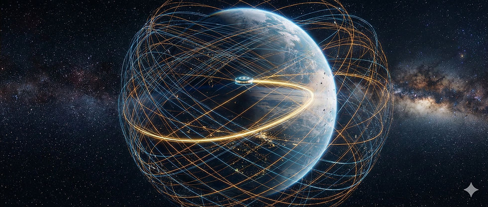
The orbital environment surrounding Earth is undergoing a phase transition of historical magnitude. Once a domain defined by the vastness of the "Big Sky," where satellites were solitary explorers in an infinite void, it has transformed into a congested industrial ecosystem. The proliferation of mega-constellations in Low Earth Orbit (LEO) and the burgeoning interest in cislunar space have stressed the traditional methods of Space Traffic Management (STM) to their breaking point. As the density of active satellites and lethal debris rises, the risk of a collisional cascade—the Kessler Syndrome—looms ever larger. This report provides an exhaustive analysis of the emerging field of dynamical cartography, a discipline that seeks to map the invisible gravitational highways and chaotic webs that permeate the space around our planet. We explore the seminal "One Million Orbits" project by Lawrence Livermore National Laboratory (LLNL), which applies high-performance computing to chart the treacherous waters of cislunar space. We examine the theoretical underpinnings of the "Arnold Web" of resonances and the "Arches of Chaos," concepts that are reshaping our understanding of orbital stability. Furthermore, we investigate the practical application of Minimum Space Occupancy (MiSO) orbits and passive debris removal strategies that exploit these natural perturbations. By synthesizing recent data from the European Space Agency’s 2025 Space Environment Report and cutting-edge astrodynamics research, this treatise argues that the future of orbital sustainability lies not in resisting the chaotic forces of the cosmos, but in mastering them.
1. Introduction: The End of the "Big Sky"
1.1 The Historical Context of Orbital Congestion
For the first five decades of the Space Age, the guiding philosophy of orbital safety was predicated on the sheer immensity of the near-Earth environment. The "Big Sky" theory posited that the volume of space available in Low Earth Orbit (LEO)—a spherical shell extending from the upper atmosphere to an altitude of 2,000 kilometers—was so vast relative to the tiny cross-sectional area of a spacecraft that the probability of a random collision was statistically negligible.1 This assumption allowed nations and operators to launch satellites with little regard for end-of-life disposal or precise orbital coordination. Rockets deposited their payloads and left their upper stages to drift; satellites were abandoned in place once their batteries failed.
This laissez-faire approach resulted in a gradual accumulation of debris, a process that accelerated imperceptibly until the turn of the millennium. The wake-up call arrived on February 10, 2009, when an operational Iridium communications satellite collided with a defunct Russian Cosmos military satellite over Siberia.2 The hypervelocity impact, occurring at speeds exceeding 25,000 kilometers per hour, shattered both objects, creating thousands of trackable shrapnel pieces and tens of thousands of smaller fragments. This event, along with the deliberate destruction of the Fengyun-1C satellite in a 2007 anti-satellite test, demonstrated that the "Big Sky" was no longer big enough to absorb our negligence.
1.2 The New Industrial Revolution in Space - the Rise of Mega-Constellations
Today, the paradigm has shifted from government-led exploration to commercial industrialization. The rise of "New Space" companies has dramatically lowered launch costs, enabling the deployment of mega-constellations—networks consisting of thousands of satellites designed to provide global internet coverage. As of the European Space Agency's (ESA) 2025 Space Environment Report, the number of tracked objects in orbit has surged to approximately 40,000.3 Of these, roughly 11,000 are active payloads, a number that has more than doubled in just a few years.
However, the active fleet is merely the tip of the iceberg. The ESA estimates that the true population of space debris larger than one centimeter—objects capable of causing catastrophic mission failure—exceeds 1.2 million.4 The population of smaller particles, ranging from one millimeter to one centimeter, is estimated at over 130 million. These "lethal non-trackable" objects pose a persistent erosive threat to solar panels and sensitive instruments, and in the worst-case scenario, can puncture pressurized hulls.
1.3 The Looming Threat of the Kessler Syndrome
The congestion is not uniform; it is clustered in specific, highly valuable altitude bands. The 500-600 kilometer shell, favored for its balance of low latency and orbital lifetime, has seen a density increase such that the number of active satellites now rivals the density of debris.5 This convergence has brought the community face-to-face with the Kessler Syndrome, a theoretical scenario proposed by NASA scientist Donald Kessler in 1978.
The Kessler Syndrome posits a tipping point where the density of objects in LEO becomes high enough that collisions between objects create a cascading chain reaction.6 In this scenario, a single collision generates a cloud of debris that spreads out in orbital phase space, increasing the probability of subsequent collisions. Recent analyses suggest we may be perilously close to this precipice. A 2025 study highlighted the "Collision Realization and Significant Harm (CRASH) Clock," indicating that a severe solar storm—which heats the atmosphere and creates unpredictable drag—could blind tracking systems long enough to trigger such a cascade.6
In this environment, "brute-force" Space Traffic Management (STM)—relying on constant propulsive maneuvers to dodge predicted impacts—is becoming operationally unsustainable. To preserve the orbital commons, we must move beyond reacting to conjunctions and begin to understand the deep, underlying structure of the space they inhabit. We need a map.
2. The Physics of the Invisible Landscape
To understand how a "map of 1 million routes" can prevent collisions, one must first appreciate that space is not a vacuum in the dynamical sense. It is a turbulent sea of gravitational forces. The motion of a satellite is governed by the laws of celestial mechanics, but the textbook version of these laws—the "Two-Body Problem"—is a simplification that hides the complex reality of the orbital environment.
2.1 Beyond Kepler: The Perturbed Universe
In the idealized Two-Body Problem, a satellite orbits a perfectly spherical Earth in a fixed elliptical path. The orbit is defined by six parameters known as Keplerian elements: the semi-major axis (size), eccentricity (shape), inclination (tilt), and three angles defining its orientation in space. In this perfect model, a satellite launched today would retrace the exact same path a million years from now.
However, the real Earth is not a sphere; it is an oblate spheroid, bulging at the equator due to its rotation. This bulge exerts a gravitational torque on satellites, causing their orbits to precess—the plane of the orbit rotates slowly in space. This effect, quantified by the zonal harmonic, is the primary perturbation in LEO.7
Beyond the shape of the Earth, satellites are subject to "third-body" perturbations from the Moon and the Sun (lunisolar gravity). While these forces are weaker than Earth's gravity, they act over long timescales, gently tugging on the orbit.7 Additionally, solar radiation pressure—the physical force of sunlight striking the spacecraft—can alter the orbits of satellites with large surface areas and low mass, effectively turning them into solar sails.
2.2 The Phenomenon of Orbital Resonance
The interaction between these periodic forces can give rise to a phenomenon known as resonance. In physics, resonance occurs when a driving force oscillates at a frequency that matches the natural frequency of a system—like pushing a child on a swing at the exact moment they reach the peak of their arc. In orbital mechanics, resonance occurs when the period of the satellite's orbit forms a simple integer ratio with the period of a perturbing body, or when the precession rates of the orbit match the motion of the Earth, Moon, or Sun.8
There are three primary types of resonances that shape the orbital landscape:
Mean-Motion Resonances (MMR): These occur when the orbital period of the satellite is a rational fraction of the Moon's or Earth's period. For example, a 2:1 resonance means the satellite completes exactly two orbits for every one orbit of the Moon. These resonances can act as "pump handles," efficiently transferring energy from the Moon's gravity into the satellite's orbit, often resulting in a dramatic increase in eccentricity.
Secular Resonances: These are more subtle and involve the slow precession of the orbit. If the rate at which a satellite's orbital plane twists (precession of the node) matches the rate at which the Moon's orbit twists, the gravitational pull of the Moon acts in the same direction for decades. This can cause the satellite's inclination to flip or its eccentricity to grow wildly.
Tesseral Resonances: Caused by the "lumpiness" of Earth's gravity field (specific mountains or density anomalies), these affect satellites whose ground tracks repeat regularly over the same geography.9
2.3 The Dynamical Skeleton
These resonances are not random; they form a structured "dynamical skeleton" within the phase space of Earth orbit.7 Phase space is a mathematical concept that maps every possible state of a satellite (its position and velocity). In this map, resonances appear as distinct lines or surfaces.
Where these resonances exist in isolation, they can provide stability, locking a satellite into a predictable pattern. However, the orbital environment is crowded with perturbations. When the "width" of one resonance overlaps with the "width" of another, the orderly surfaces of the phase space break down.
3. The Architecture of Chaos: The Arnold Web
The intersection of multiple resonances creates one of the most complex and fascinating structures in classical mechanics: the Arnold Web. Named after the mathematician Vladimir Arnold, this structure describes the topology of phase space in systems with three or more degrees of freedom, such as a satellite perturbed by both the Moon and the Sun.
3.1 The Web and Stochastic Layers
Imagine the phase space as a vast ocean. The resonances are like currents flowing through this ocean. In a simple system, these currents are separated by calm water (invariant tori) where orbits are stable. However, in the multi-body environment of Earth orbit, the intersections of these currents create turbulence. These turbulent junctions are known as "stochastic layers".7
The Arnold Web is the interconnected network of these stochastic layers. It permeates the orbital phase space like a dense spiderweb. A satellite trapped in one of these chaotic layers is no longer bound to a regular, repeating torus. Instead, it is subject to chaotic diffusion.
3.2 Chaotic Diffusion: The Slow Drift
Chaotic diffusion is a mechanism by which an orbit can slowly drift through the phase space, moving along the threads of the Arnold Web.10 Unlike the rapid instability seen in strongly chaotic systems, Arnold diffusion is typically slow. A satellite might appear stable for decades, its elements oscillating slightly but remaining bounded. Then, as it drifts along a resonance channel and encounters a junction in the web, its behavior can change radically.
This phenomenon explains the "mystery" of why satellites in Medium Earth Orbit (MEO)—the home of GPS, Galileo, and GLONASS navigation constellations—can suddenly destabilize. MEO is riddled with lunisolar secular resonances. A defunct satellite left in a "graveyard" orbit might drift along a resonant filament for fifty years, only to have its eccentricity suddenly "pumped up" by the interaction of overlapping resonances.9 This sudden change can send the dead satellite diving back into the operational constellation, posing a collision risk that was not predicted by simple Keplerian models.
3.3 The Arches of Chaos
Recent research has visualized the most prominent of these manifolds in the solar system as the "Arches of Chaos".11 These are large-scale structures that act as boundaries between different dynamical regimes. They have been described as "celestial autobahns"—fast-transport channels that connect different regions of the solar system.
In the context of Earth orbit, these arches represent the separatrices (boundaries) of the major resonances. They are the "continental divides" of gravity. A satellite placed precisely on such an arch is in a precarious balance; a tiny nudge can send it falling into a stable resonance or drifting out into the chaotic sea. Mapping these arches is crucial for identifying "safe harbors" where satellites can remain stable without station-keeping, and "disposal chutes" where debris will naturally be cleared away.11
4. The Cislunar Challenge: Mapping the Frontier
While the congestion in LEO is the immediate crisis, the next frontier of space exploration lies in the region between Geostationary Orbit (GEO) and the Moon, known as cislunar space. As nations and corporations plan permanent lunar bases, gateways, and mining operations, the need for a traffic management system in this vast volume has become urgent.
4.1 The Three-Body Problem Reborn
Navigating cislunar space is fundamentally different from navigating LEO. In LEO, Earth's gravity dominates, and the Moon is a mere perturbation. In cislunar space, the gravitational pull of the Moon becomes comparable to that of the Earth. The dynamics are no longer governed by the perturbed Two-Body Problem but by the Circular Restricted Three-Body Problem (CR3BP).12
In this regime, familiar concepts like "orbit" and "period" lose their clear meaning. Trajectories can be chaotic, looping wildly around both the Earth and Moon. Stable orbits are rare and often counter-intuitive, such as the "halo orbits" that circle empty points in space (Lagrange points) rather than a physical body.
4.2 The LLNL "One Million Orbits" Project
To bring order to this chaos, researchers at the Lawrence Livermore National Laboratory (LLNL) undertook a massive computational survey titled "One Million Open-source Cislunar Orbits".13 Recognizing that the "Big Sky" theory would fail even in the vastness of cislunar space if traffic concentrated in narrow corridors, the team set out to map the dynamical geography of the region.
Methodology and SSAPy: The project utilized SSAPy (Space Situational Awareness for Python), a specialized software tool developed at LLNL.15 Unlike standard propagators, SSAPy is designed to handle the high-fidelity force models required for cislunar trajectories, including:
High-order Earth and Lunar gravity models (spherical harmonics).
Solar and Earth radiation pressure.
Third-body perturbations from the Sun and planets.
Using the laboratory's supercomputing capabilities, the team simulated one million distinct trajectories over a six-year period. This "brute-force" approach was necessary to capture the full diversity of behaviors in the chaotic phase space.
4.3 Findings: The Needles in the Haystack
The results of the LLNL study confirmed the inherent instability of the cislunar environment. Of the one million simulated orbits, only 9.7% remained stable for the full six-year duration.14 The vast majority of trajectories eventually succumbed to gravitational perturbations, either escaping the system or colliding with the Earth or Moon.
To make sense of this massive dataset, the researchers employed unsupervised machine learning techniques, specifically Self-Organizing Maps (SOMs).16 Because cislunar orbits do not fall into neat categories like "circular" or "elliptical," the SOMs were used to cluster orbits based on their dynamical evolution.
The analysis revealed specific "stable bands" in the Keplerian element space—regions where orbits could persist without active station-keeping. One notable finding was a region of stability located at approximately five geosynchronous radii.14 This discovery identifies a potential "parking lot" for future cislunar infrastructure—a region where a fuel depot or communications relay could sit with minimal fuel consumption. Conversely, the study identified the "busy intersections" where unstable trajectories tend to converge, providing a map of high-risk zones that future missions should avoid or traverse with caution.17
5. Engineering Stability: MiSO Orbits and Mega-Constellations
The insights gained from mapping the Arnold Web and cislunar space are not just academic; they are being applied to solve the pressing problems of LEO mega-constellations. Companies like SpaceX (Starlink) and OneWeb are deploying thousands of satellites into shells that are dynamically fragile.
5.1 The Station-Keeping Problem
In a nominal constellation design, satellites are placed in perfect circles at specific inclinations. However, due to the effect and atmospheric drag, these orbits degrade. To maintain the constellation's geometry (and prevent collisions), satellites must constantly fire their thrusters. This "station-keeping" consumes fuel and introduces unpredictability. If a satellite's thruster fails, it becomes a drifting derelict that threatens the rest of the shell.
5.2 Minimum Space Occupancy (MiSO)
Research by Aaron Rosengren, Claudio Bombardelli, and their colleagues has introduced a solution derived from dynamical cartography: Minimum Space Occupancy (MiSO) orbits.7
The concept of MiSO is a generalization of the "frozen orbit." In a frozen orbit, the initial conditions are chosen so that the secular perturbations from Earth's oblateness cancel out the oscillations in eccentricity and argument of perigee. The orbit appears "frozen" in shape.
MiSO extends this concept to the full, messy reality of the Earth-Moon-Sun system. It uses numerical optimization to find initial conditions that minimize the "swept volume"—the physical space occupied by the satellite's trajectory over time.19
5.3 Reducing Collision Risk by Design
The application of MiSO theory to mega-constellations has yielded promising results. In simulations of the OneWeb and Starlink constellations, researchers found that adopting MiSO configurations could significantly reduce the risk of endogenous collisions (collisions between members of the same constellation).18
By placing satellites into these natural dynamical grooves, the relative motion between them becomes more predictable. They oscillate less, meaning the "error bubbles" around each satellite are smaller. Crucially, the study found that achieving a MiSO configuration often requires "nearly indistinguishable adjustments" to the nominal orbital elements.18 This means operators can gain a significant safety margin essentially for free, simply by choosing their injection parameters to align with the dynamical skeleton of the local phase space.
6. The Disposal Crisis and Passive Remediation
Perhaps the most revolutionary application of the Arnold Web is in the realm of space debris removal. As the "25-year rule" for post-mission disposal tightens to five years or less, operators are looking for ways to clear dead satellites from orbit without carrying massive amounts of extra fuel.
6.1 The Graveyard Trap
For high-altitude orbits like MEO and GEO, bringing a satellite back to Earth for atmospheric reentry is energetically prohibitive—it requires a velocity change () of thousands of meters per second. The traditional solution has been to boost these satellites into "graveyard orbits" slightly above the operational zone.
However, Rosengren’s dynamical mapping of the Galileo constellation revealed a critical flaw in this strategy. Many of the proposed graveyard orbits for Galileo were located deep within the chaotic web of lunisolar resonances.9 A satellite parked there would not remain stable. Over decades, chaotic diffusion would pump its eccentricity, potentially causing it to dive back through the operational constellation.
6.2 Surfing the Resonances to Oblivion
Dynamical cartography offers a way to turn this problem into a solution. Instead of viewing resonances as threats, they can be used as disposal chutes. This concept is known as Passive Debris Removal.
By analyzing the Arnold Web, astrodynamicists can identify specific "escape hatches"—resonances that lead to extreme eccentricity growth.7 If an operator can gently nudge a retiring satellite into one of these resonant channels, the natural gravitational perturbations will take over.
Entry: The satellite performs a small maneuver to enter the resonance.
Transport: Over a period of years, the resonance pumps the orbit's eccentricity, making it more and more elliptical.
Demise: Eventually, the perigee (the lowest point of the orbit) drops deep enough into the Earth's atmosphere that drag captures the satellite, causing it to burn up.
This approach requires a paradigm shift in mission planning. It demands "Demise Design"—selecting operational orbits not just for their utility, but for their proximity to these natural exit ramps. It transforms the chaotic forces of the solar system from a liability into a free source of propulsion for cleaning up our orbital mess.7
7. Computational Frontiers and the Curse of Dimensionality
Creating these maps is one of the grand challenges of modern computational physics. The phase space of a satellite is six-dimensional. Mapping the stability of every point in this 6D volume involves solving the N-body problem for millions of initial conditions over timescales of decades or centuries.
7.1 The Curse of Dimensionality
This problem is plagued by the "Curse of Dimensionality".20 As the number of dimensions increases, the volume of the space explodes exponentially. A simple grid search that works in 2D becomes computationally impossible in 6D. This is why the LLNL project required supercomputing resources to map even a fraction of cislunar space.
7.2 Chaos Indicators
To manage this complexity, researchers use mathematical tools called chaos indicators. The most prominent of these is the Fast Lyapunov Indicator (FLI).9 The FLI measures how quickly two initially close orbits diverge from each other.
Low FLI: Indicates regular, stable motion (an island of stability).
High FLI: Indicates chaotic motion (part of the Arnold Web).
By computing the FLI for millions of points, researchers can generate color-coded maps that reveal the intricate structure of the web—the "Arches," the "channels," and the "islands"—without having to visually inspect every trajectory.
7.3 The Uncertainty Monster: Atmospheric Drag
While gravitational maps are precise, maps of LEO face a chaotic variable that cannot be easily predicted: the atmosphere. Atmospheric drag is the largest source of uncertainty in orbit prediction.22
The density of the upper atmosphere is driven by space weather. A solar flare can heat the atmosphere, causing it to expand and increasing the drag on satellites by orders of magnitude.24 This introduces a stochastic (random) element to the map. A satellite might be safe in a "stable" resonance during a solar minimum, but a solar storm could knock it into a chaotic layer.
This uncertainty was highlighted by the "Crash Clock" analysis in 2025, which showed that a severe solar storm could reduce the time available to coordinate collision avoidance maneuvers to less than three days.6 This underscores the need for maps that are not static, but probabilistic—maps that show "tubes" of probability rather than thin lines of certainty.
8. Conclusion: From Avoidance to Resilience
The headline question—"Can this map of 1 million routes help prevent satellite collisions?"—can be answered with a qualified "yes," but the implications go far beyond simple collision avoidance. The work of LLNL, Rosengren, and the broader astrodynamics community represents a fundamental shift in our relationship with the space environment.
We are moving from an era of Newtonian determinism, where we viewed orbits as fixed geometric lines, to an era of dynamical stewardship. We now understand that Earth orbit is an ecosystem with its own geography—a geography of invisible currents, chaotic webs, and stable harbors.
The "One Million Orbits" dataset provides the baseline for the future of cislunar commerce, identifying the safe trade routes and the dangerous shoals. The application of MiSO orbits to mega-constellations demonstrates that we can "bake in" safety by aligning our industrial infrastructure with the natural dynamics of the planet. And the use of resonances for passive disposal offers a sustainable path to mitigating the debris crisis.
As the number of objects in orbit surges toward 100,000 and beyond, the margin for error has vanished. We can no longer afford to fight the gravity of the Earth-Moon-Sun system. The future of spaceflight depends on our ability to read the map of the Arnold Web and surf the arches of chaos. The "Big Sky" is gone; it is time to learn the currents of the "Big Ocean."
Table 1: The Statistical Reality of Earth Orbit (2025/2026)
Metric | Estimated Count | Significance | Source |
Tracked Objects | ~40,000 | Objects large enough to be tracked by radar/optical sensors. | 3 |
Active Payloads | ~11,000 | Functional satellites providing services (GPS, Internet, Science). | 3 |
Debris > 10 cm | > 54,000 | Objects capable of catastrophic fragmentation upon impact. | 4 |
Debris 1 cm – 10 cm | > 1.2 Million | "Lethal Non-Trackable" objects; can destroy a satellite but are hard to see. | 4 |
Debris 1 mm – 1 cm | > 130 Million | Erosive threat; can degrade solar panels and sensors. | 4 |
Collision Events | 4 (Catalogued) | Rare but catastrophic; major drivers of debris population growth. | 1 |
Fragmentation Events | > 650 | Explosions of batteries/tanks that create debris clouds. | 1 |
Table 2: Key Concepts in Dynamical Cartography
Term | Definition | Application in STM |
Arnold Web | A network of intersecting resonances in phase space where chaotic diffusion occurs. | Identifies regions of long-term instability to avoid for active satellites. |
MiSO Orbit | Minimum Space Occupancy orbit; generalizes frozen orbits to perturbed dynamics. | Reduces collision risk and fuel use for mega-constellations. |
Arches of Chaos | Manifolds acting as boundaries/channels in the solar system. | Used for rapid, low-energy transport or disposal. |
CR3BP | Circular Restricted Three-Body Problem. | The mathematical model required for navigating cislunar space. |
FLI | Fast Lyapunov Indicator. | A computational tool to detect chaos and map the stability of orbits. |
Kessler Syndrome | A cascading chain reaction of collisions generating more debris. | The "worst-case scenario" that dynamical mapping aims to prevent. |
Works cited
Can Space Debris Block Access to Outer Space? - Forethought, accessed February 12, 2026, https://www.forethought.org/research/space-debris-and-launch-denial
We now have satellite traffic jams in space | Next Nature, accessed February 12, 2026, https://nextnature.org/en/magazine/story/2024/we-now-have-satellite-trafic-jams-in-space
ESA Space Environment Report 2025, accessed February 12, 2026, https://www.esa.int/Space_Safety/Space_Debris/ESA_Space_Environment_Report_2025
Space Environment Statistics - Space Debris User Portal - ESA, accessed February 12, 2026, https://sdup.esoc.esa.int/discosweb/statistics/
ESA Space Environment Report 2025 | UN-SPIDER Knowledge Portal, accessed February 12, 2026, https://www.un-spider.org/news-and-events/news/esa-space-environment-report-2025
Kessler syndrome - Wikipedia, accessed February 12, 2026, https://en.wikipedia.org/wiki/Kessler_syndrome
Passive debris removal using orbital resonances Aaron J ..., accessed February 12, 2026, https://amostech.com/TechnicalPapers/2018/Orbital-Debris/Rosengren.pdf
Orbital resonance - Wikipedia, accessed February 12, 2026, https://en.wikipedia.org/wiki/Orbital_resonance
galileo disposal orbit strategy: resonances, chaos, and ... - ISSFD, accessed February 12, 2026, https://issfd.org/2015/files/downloads/papers/160_Rosengren.pdf
Analysis of the chaotic behaviour of orbits diffusing along the Arnold ..., accessed February 12, 2026, https://www-n.oca.eu/elena/celmec.pdf
The arches of chaos in the Solar System - ResearchGate, accessed February 12, 2026, https://www.researchgate.net/publication/347240463_The_arches_of_chaos_in_the_Solar_System
Orbital Motion in Cislunar Space - YouTube, accessed February 12, 2026, https://www.youtube.com/watch?v=jmeAML-ekuo
Simulations and supercomputing calculate one million orbits in cislunar space, accessed February 12, 2026, https://www.llnl.gov/article/53986/simulations-supercomputing-calculate-one-million-orbits-cislunar-space
(PDF) SSAPy - Space Situational Awareness for Python - ResearchGate, accessed February 12, 2026, https://www.researchgate.net/publication/394717556_SSAPy_-_Space_Situational_Awareness_for_Python
llnl/SSAPy: A Python package allowing for fast and precise orbital modeling. - GitHub, accessed February 12, 2026, https://github.com/llnl/SSAPy
Classification of Cislunar Orbits Using Self-Organizing Maps (SOMs) Denvir Higgins Lawrence Livermo - AMOS Conference, accessed February 12, 2026, https://amostech.com/TechnicalPapers/2024/Poster/Higgins.pdf
LLNL: Simulations and Supercomputing Calculate 1M Orbits in Cislunar Space - HPCwire, accessed February 12, 2026, https://www.hpcwire.com/off-the-wire/llnl-simulations-and-supercomputing-calculate-1m-orbits-in-cislunar-space/
Assessing and Minimizing Collisions in Satellite Mega ..., accessed February 12, 2026, https://www.researchgate.net/publication/348626485_Assessing_and_Minimizing_Collisions_in_Satellite_Mega-Constellations
Assessing and Minimizing Collisions in Satellite Mega-Constellations - AMOS Conference, accessed February 12, 2026, https://amostech.com/TechnicalPapers/2019/Astrodynamics/Reiland.pdf
The Curse of Dimensionality: De-identification Challenges in the Sharing of Highly Dimensional Datasets - The Future of Privacy Forum, accessed February 12, 2026, https://fpf.org/blog/the-curse-of-dimensionality-de-identification-challenges-in-the-sharing-of-highly-dimensional-datasets/
Stretching in Phase Space and Applications in General Nonautonomous Multi-Body Problems? - Purdue Engineering, accessed February 12, 2026, https://engineering.purdue.edu/people/kathleen.howell.1/Publications/Journals/2015_CMDA_ShoBlaHowHal.pdf
accessed February 12, 2026, https://www.swpc.noaa.gov/impacts/satellite-drag#:~:text=The%20largest%20uncertainty%20in%20determining,waves%20%5B5%2C%206%5D.
UNCERTAINTY CHARACTERIZATION OF ATMOSPHERIC DENSITY MODELS FOR ORBIT PREDICTION OF SPACE DEBRIS, accessed February 12, 2026, https://conference.sdo.esoc.esa.int/proceedings/sdc7/paper/365/SDC7-paper365.pdf
Satellite Drag | NOAA / NWS Space Weather Prediction Center, accessed February 12, 2026, https://www.swpc.noaa.gov/impacts/satellite-drag


Comments